DE
DE  EN
EN  ES
ES Have you ever wondered why the Canary Islands feature such spectacular landscapes, black beaches, and bizarre lava fields?
The answer lies deep beneath your feet: volcanoes. The Canary Islands are entirely of volcanic origin. Without fire, lava, and eruptions, there would be neither Mount Teide nor Timanfaya National Park, nor the fresh lava fields of La Palma.
In this comprehensive guide, you’ll learn about all known historical volcanic eruptions of the Canary Islands, including dates, fascinating background information, and - most importantly - whether and how you can visit these volcanic landscapes today. Perfect for planning your next Canary Islands vacation!
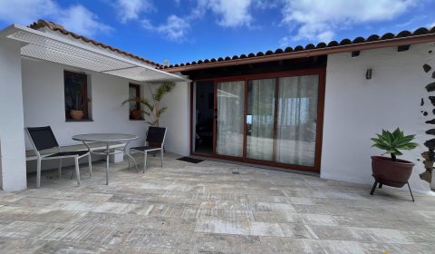
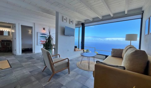
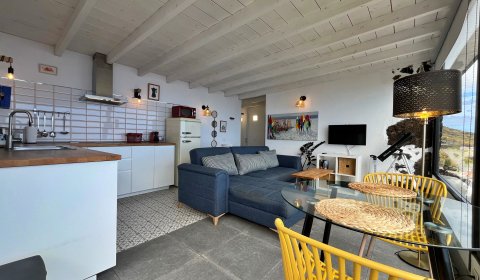
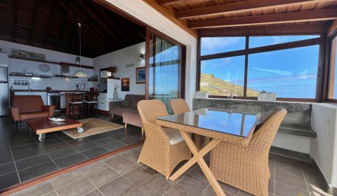
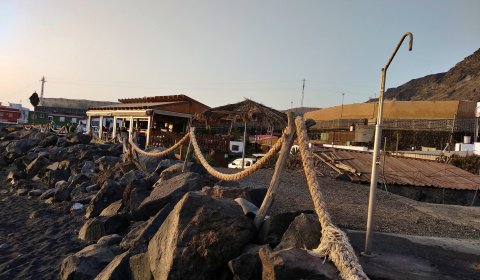
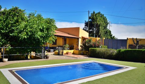
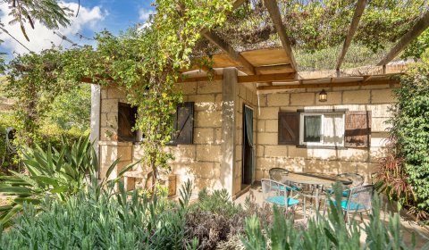
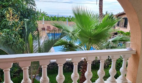
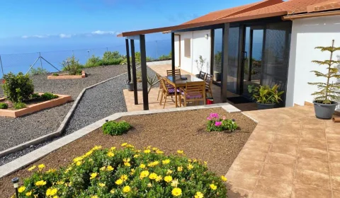
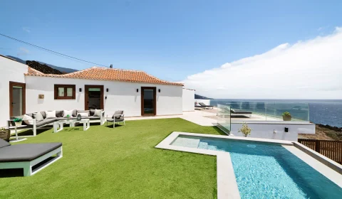
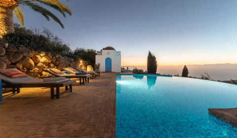
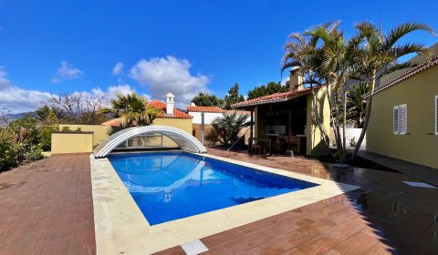
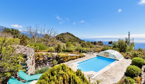
Holiday Accommodations Canary Islands
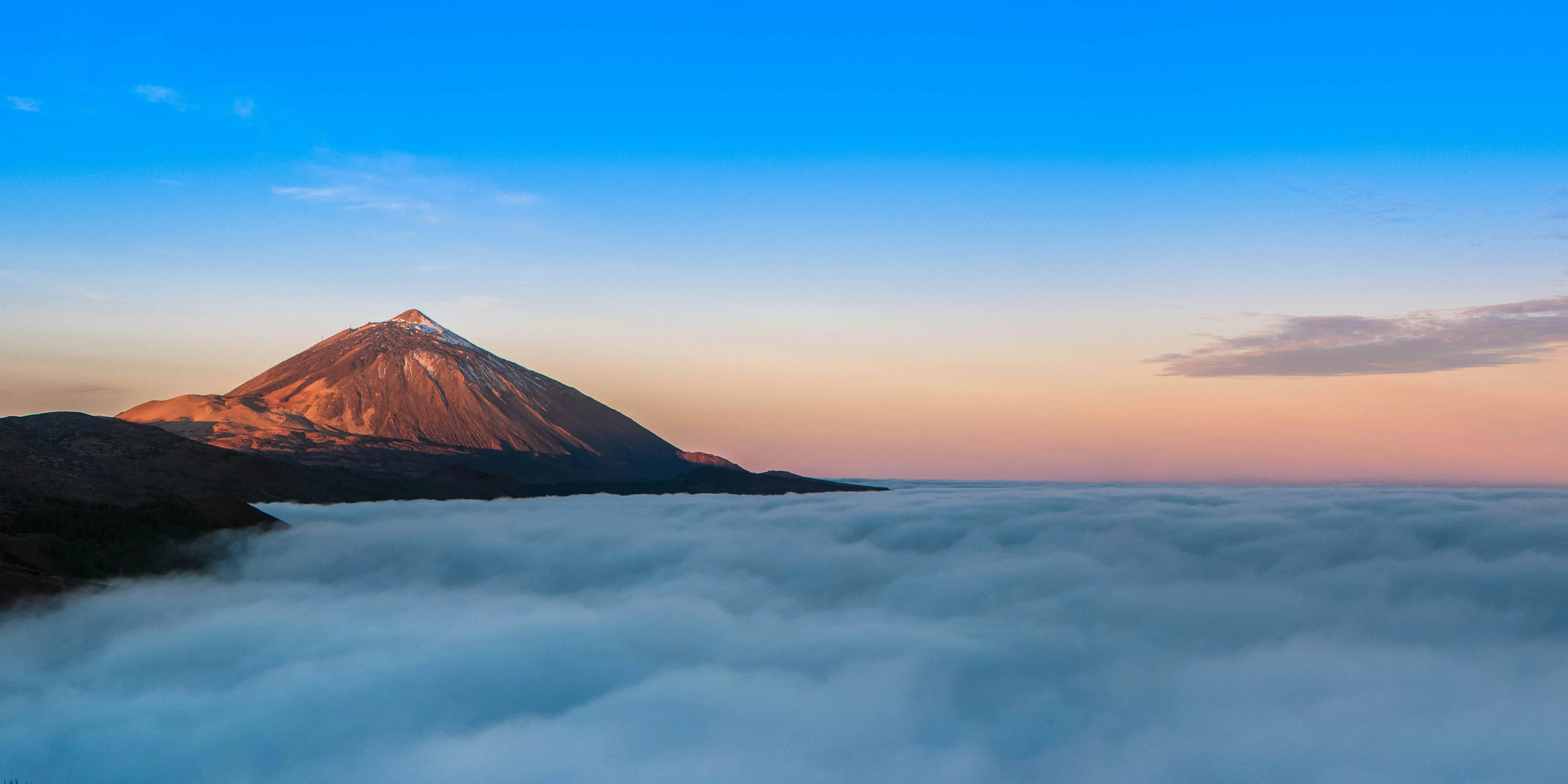
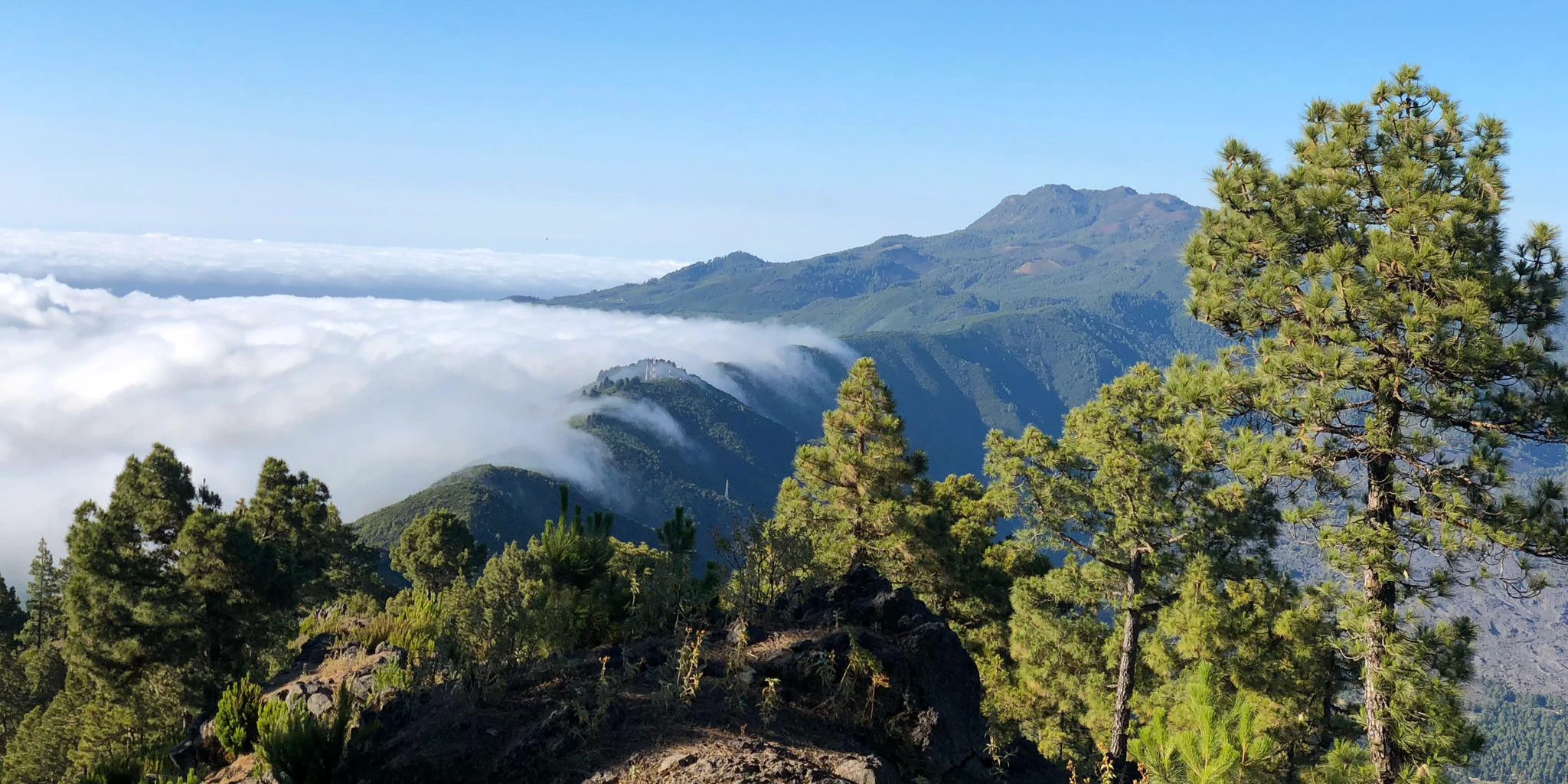
Tenerife – The Volcanic Island with Mount Teide
1341 – Unknown Eruption
Location
not clearly localized (probably central or northwestern part of the island)
Background and historical context
The volcanic eruption of 1341 is considered the oldest eruption on Tenerife that is documented in writing. It is not supported by archaeological findings but is known from medieval chronicles and seafarers’ reports describing smoke, fire phenomena, and tremors on the island. At that time, the Guanches, the indigenous people of Tenerife, were still living without European influence.
Since there are no precise geographical descriptions, volcanologists assume that the eruption may have occurred either in the Teide central massif, in the area of today’s northwestern rift zone, or along a fissure that was active at the time. The lack of precise localization is typical for very early eruptions, as there were neither maps nor scientific observations.
Type of eruption
It was probably an effusive eruption (lava flow) accompanied by smoke and ash emissions, but without catastrophic consequences for the population. There are no records indicating large-scale destruction or casualties.
Visiting and touristic significance today
Even though you cannot visit a specific volcano from 1341, this eruption is an important part of Tenerife’s volcanic identity. The landscapes you see today in Teide National Park, the Orotava Valley, or along the rift zones are the result of a long sequence of such early eruptions.
Interesting for visitors
Many hiking trails in Teide National Park cross lava formed during similarly ancient eruptive phases
Viewpoints such as Mirador de La Tarta impressively display the geological layers of past eruptions
Visitor centers like El Portillo explain, using models and information panels, how early eruptions shaped the island
Visitor center and useful information
At the El Portillo Visitor Center, you can learn more about Tenerife’s early volcanic activity - including eruptions that are known only from historical sources.
1430 – Taoro / Orotava Valley
Location
Orotava Valley (Valle de La Orotava), north coast of Tenerife
Background and history of the eruption
The eruption of 1430 took place in the territory of the former Menceyato of Taoro, one of the most important Guanche kingdoms. From a volcanological perspective, it is assumed to have been a fissure eruption, during which lava emerged from several cracks in the ground - typical of Tenerife’s northwestern rift zone.
Contemporary accounts report lava flows and intense smoke development that affected large parts of what is now the Orotava Valley. The eruption likely had a major impact on the landscape at the time, destroying vegetation but at the same time creating the fertile soils for which the region is known today.
Visiting and experiences for vacationers
The area is now easily accessible and offers you numerous opportunities to experience volcanic landscapes and nature:
Hikes through ancient lava zones around La Orotava, Santa Úrsula, and Los Realejos
Mirador Humboldt – spectacular view over the entire valley all the way to Mount Teide
Mirador de La Corona – views of ancient crater structures and lava flows
Walking paths through historic villages built on volcanic ground
Guided hikes
Guided volcano and nature hikes are regularly offered in the Orotava Valley. During these tours, you’ll learn how to identify ancient lava flows and what role the 1430 eruption played in shaping today’s landscape. Combination tours featuring culture, nature, and volcanism are particularly popular.
Visitor centers and museums
Although there is no dedicated volcano museum in the Orotava Valley itself:
The El Portillo Visitor Center (Teide National Park) explains the volcanic development of northern Tenerife
Local museums in La Orotava convey the history of the Guanches and their relationship with the volcanic environment
Even though you cannot visit a single crater from 1430, you are moving directly across the results of this eruption in the Orotava Valley. The lush vegetation, terraced slopes, and wide views over the north coast exist precisely because of this volcanic activity.
Tip for visitors: Combine a hike through the Orotava Valley with a visit to the historic old town of La Orotava or a drive to higher elevations toward Teide - this way, you can experience the full spectrum of Tenerife’s volcanic formation in just one day.
1492 – Historic eruption in the time of Christopher Columbus
Location
probably central Tenerife (Teide area or northwestern rift zone)
Background and historical sources
The eruption of 1492 is particularly well known because it was documented by Christopher Columbus himself. During his voyage to America, Columbus stopped on La Gomera and reported a volcanic eruption on the neighboring island of Tenerife. His notes mention fire phenomena, smoke, and ash visible over the sea.
Since no scientific volcanic observation existed at the time, the exact location of the eruption has not been clearly recorded. Today, volcanologists assume that the eruption occurred in the Teide central massif or along a rift zone.
Type of eruption
Probably an effusive eruption with lava flows and moderate explosivity. There are no indications of major destruction or casualties, suggesting that the eruption was relatively short-lived and locally limited.
Visiting and touristic significance today
Even though you cannot visit a specific “Columbus volcano,” you are exploring landscapes in Teide National Park that were shaped by exactly such historical eruptions.
Visitor centers
El Portillo – explains the volcanic history of Tenerife
Telesforo Bravo – focuses on Mount Teide and historical eruptions
Our tip: This eruption uniquely combines volcanism with world history - ideal if you want to blend nature experiences with historical context.


1704 to 1705 – Fasnia, Siete Fuentes & Volcán de las Arenas
Location
Southeast Tenerife – present-day municipalities of Fasnia and Arafo, located along the island’s southeast rift zone
Background and history of the eruption
Between December 1704 and March 1705, a series of successive fissure eruptions occurred in this region. The ground opened at several locations, either simultaneously or at different times, allowing lava to emerge from multiple cinder cones and fissures. The main eruption centers were Siete Fuentes, Fasnia, and the Volcán de las Arenas.
Contemporary reports describe months of tremors, smoke emissions, and ash fall that severely disrupted daily life for the local population. Lava flows destroyed farmland, grazing areas, and water sources. Several villages had to be temporarily evacuated. Despite the long duration of the eruption, no fatalities are documented, which is attributed to timely evacuation and the predominantly effusive nature of the eruptions.
Volcanological characteristics
The 1704–1705 eruption is considered a classic example of fissure volcanism on Tenerife. Unlike eruptions from a single central crater, multiple cinder cones formed here, many of which are still clearly visible today. The lava was predominantly basaltic, relatively low in viscosity, and spread slowly but steadily across the landscape.
This eruption also initiated a phase of increased volcanic activity that culminated just one year later in the Montaña Negra eruption (1706) near Garachico.
Visiting and hiking opportunities today
The area is one of the least touristic volcanic regions of Tenerife and offers a particularly authentic nature experience. Many trails follow historic paths once used by farmers and shepherds and now provide direct views of the eruption’s impact.
Guided hikes
In the Arafo and Fasnia region, geologically guided hikes are regularly offered. During these tours, you will learn how fissure eruptions form, how to identify ancient lava flows, which craters belong to which eruption centers, and how nature and agriculture recovered after the eruption.
Visitor centers and information services
There is no dedicated volcanic visitor center in this region. However, for more in-depth information, it is recommended to visit the El Portillo Visitor Center in Teide National Park and the local environmental and nature centers in Arafo.
Tip for your vacation: If you want to experience Tenerife away from the well-known highlights, this area is ideal. Combine your hike with a visit to traditional villages such as Arafo to connect volcanism with Canarian rural life.
1706 – Montaña Negra (Garachico)
Location
Northwest Tenerife, above the coastal town of Garachico
Background and historical significance
The eruption of Montaña Negra in 1706 is one of the most consequential events in the island’s history. At that time, Garachico was Tenerife’s most important trading and harbor town, through which most exports - especially sugar, wine, and cochineal - were handled.
On May 5, 1706, several vents opened on the flank of Montaña Negra. Over the course of several days, enormous volumes of extremely fluid lava flowed downhill. The lava carved its way directly through the town, eventually reaching the Atlantic Ocean and burying the entire natural harbor beneath a thick layer of lava. Garachico’s economic decline was thus sealed, as other ports such as Santa Cruz subsequently took over the leading role.
Remarkably, despite the massive destruction, no fatalities are recorded. The population was able to flee in time, making this eruption an impressive example of human adaptability to volcanism.
Type of eruption
This was an effusive eruption with very low-viscosity, basaltic lava. The lava flowed quickly, evenly, and over long distances - ideal for covering large areas but comparatively low in explosiveness. This high fluidity allowed the lava to reach the sea and create new coastal lines.
In the ocean, the lava solidified into bizarre rock formations and laid the foundation for today’s natural swimming pools (charcos) of Garachico. These natural lava pools are now one of the most famous landmarks of northern Tenerife and vividly demonstrate how a natural disaster can transform into a tourist attraction.
Visiting and highlights today
Today, Garachico is a prime example of how a town has come to terms with its volcanic past:
Walks across cooled lava directly within the town
Charcos Naturales de Garachico – swimming in lava pools filled with Atlantic seawater
Historic town center with churches, monasteries, and squares built directly on lava
Coastal paths with views of ancient lava tongues extending into the sea
Hiking and exploration
In the surroundings of Garachico, you will find several short hiking and walking routes that lead through old lava fields. Guided town and volcano tours are also available, offering insights into how the 1706 eruption continues to shape the townscape today.
Visitor information & useful facts
Although there is no dedicated volcano museum, numerous information panels throughout the town explain the eruption. The Convento de San Francisco provides historical insights into the period before and after 1706. Additionally, a visit to the El Portillo Visitor Center in Teide National Park is worthwhile to place the eruption in its geological context.
Traveler’s tip: Plan your visit early in the morning or at sunset. At these times, the black lava formations appear especially striking, and you can experience Garachico in a peaceful atmosphere - including a swim in the lava pools that originated directly from the 1706 volcanic eruption.
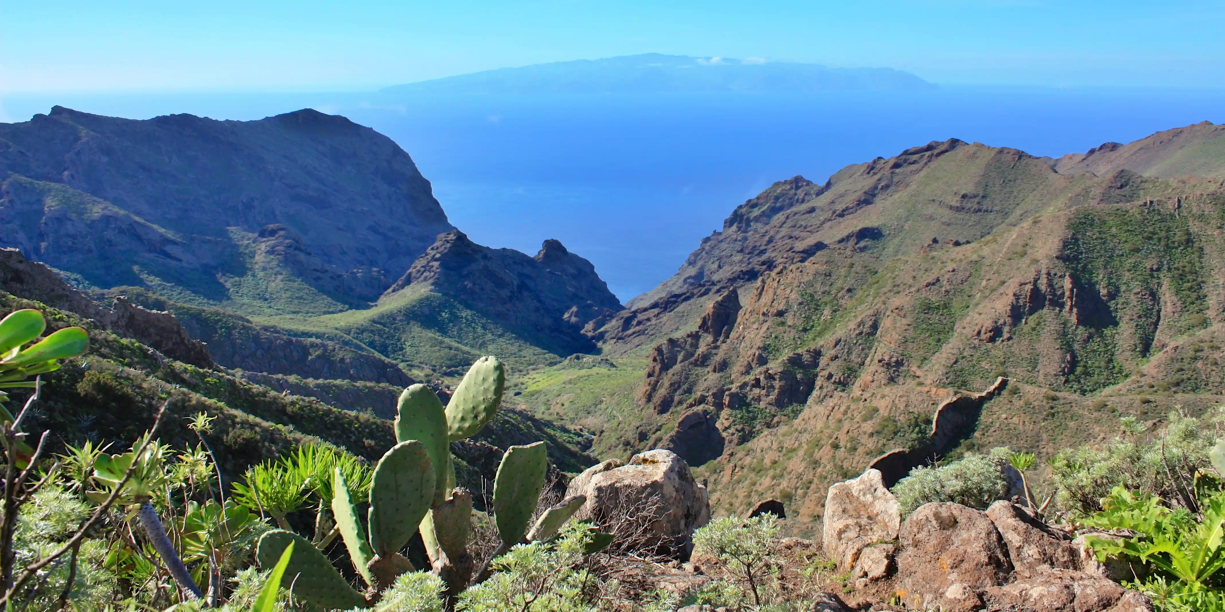
1798 – Chahorra / Pico Viejo
Location
Southwest of the Teide summit, within today’s Teide National Park
Background and history of the eruption
The eruption of Chahorra in 1798 is considered one of the longest and best-documented historical eruptions on Tenerife. It began on June 9, 1798, and lasted for almost three months, until mid-September. The eruption did not take place at Teide’s main summit but at Pico Viejo, a massive subsidiary volcano that is part of the central volcanic complex.
During the eruption, several vents opened, releasing lava, gases, and ash. The lava flowed mostly slowly but continuously, forming extensive lava fields that permanently altered the high plateau. Contemporary reports describe nighttime fire fountains that were reportedly visible even from the coast - a spectacular natural phenomenon for the population at the time.
Despite the long duration and the large volumes of lava, there were no known fatalities. The remote high-altitude location of the eruption area played a decisive role in preventing damage to settlements.
Pico Viejo is one of the most impressive volcanoes in the Canary Islands. Its crater measures approximately 800 meters in diameter, making it one of the largest volcanic craters in the archipelago. Particularly striking are the so-called “Narices del Teide” (Noses of Teide) - several well-preserved eruption vents that were active during the 1798 eruption and are still clearly visible today.
The lava from the eruption is predominantly basaltic, rich in gases, and displays a characteristic dark coloration. It forms a strong contrast to the lighter pumice and ash deposits of other Teide eruptions.
Visiting and hiking today
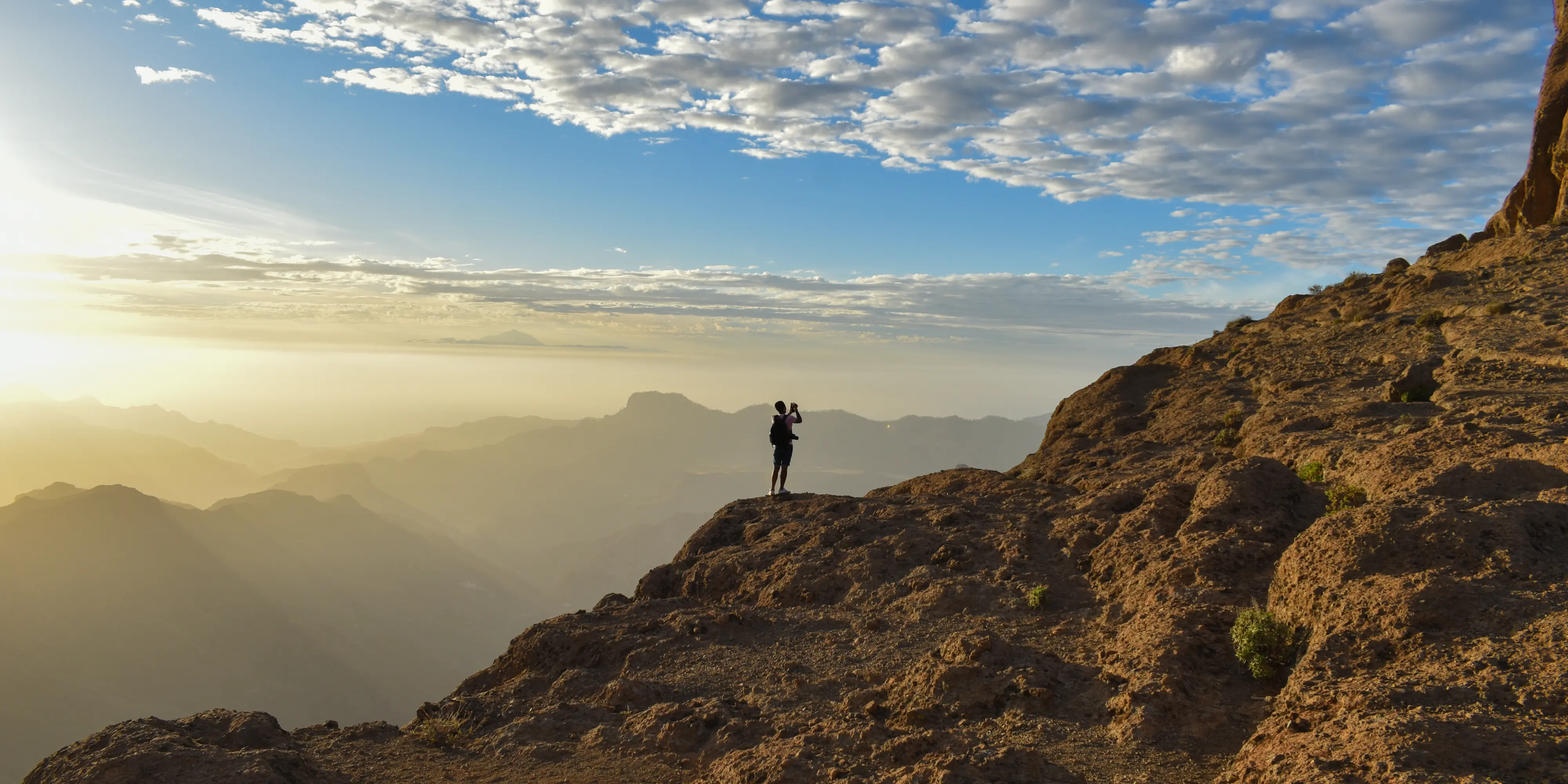
The eruption area lies entirely within Teide National Park, a UNESCO World Heritage Site, and offers some of the most spectacular volcanic hikes in Europe. The trails are well marked but require sure-footedness, physical fitness, and weatherproof equipment, as weather conditions at this altitude can change rapidly.
Guided tours
For less experienced hikers or those seeking more in-depth information, guided volcanic hikes are available. Volcano guides explain the course of the 1798 eruption, the formation of the Narices del Teide, differences between various lava types, and the role of Pico Viejo within the overall Teide system.
Visitor centers and places of knowledge
Visiting the two main information centers of the national park - the El Portillo Visitor Center and the Telesforo Bravo Visitor Center—is particularly worthwhile for better contextualizing the 1798 eruption. Both centers offer exhibitions, films, and explanatory graphics.
Tip for your vacation: Plan your hike only in stable weather conditions and start early in the day. If you combine Pico Viejo with a Teide cable car ride, you can experience one of Europe’s most spectacular volcanic landscapes in a single day - an absolute highlight for active travelers.
1909 – Chinyero (last historical eruption on Tenerife)
Location
Northwestern area of Teide National Park, between Santiago del Teide and El Tanque
Background and history of the eruption
The eruption of Chinyero began on November 18, 1909, and ended after just nine days - a comparatively short but impressive volcanic process. It is considered the most recent historical eruption on Tenerife and is therefore of particular interest to volcanologists.
The eruption began without much warning. Eyewitnesses reported earthquakes, ground fissures, and glowing lava fountains, which were especially visible at night. Basaltic lava emerged from several openings and spread slowly across the terrain. Due to the remote highland location, there were no human casualties; only agricultural land and grazing areas were damaged.
Chinyero is a classic monogenetic cinder cone, meaning it was formed by a single eruption and remained inactive afterward. Its lava field is among the youngest and best preserved in the Canary Islands.
Visiting and hiking today
Chinyero is one of the most accessible volcanoes on Tenerife and is especially popular with visitors who want to experience volcanic landscapes without great physical effort. The hike runs directly along the edge of the lava field and allows you to observe the effects of the 1909 eruption at close range.
Guided hikes
Regularly guided volcanic hikes are offered, mainly by local nature and hiking guides. The tours combine nature, history, and geology in an easy-to-understand way.
Visitor centers and information services
Chinyero itself does not have its own visitor center, but you can obtain well-founded information at the El Portillo Visitor Center (Teide National Park), at local hiking and environmental centers in the northwest of the island, and through information panels along the hiking route.
Traveler’s tip: If you only want to do one volcanic hike on Tenerife, Chinyero is the best choice. Plan about 2–3 hours, start as early as possible in the day, and bring enough water.
La Palma – The most active volcanic island
1470 to 1492 – Montaña Quemada (La Palma)
Location
Central Cumbre Vieja, in the south of the island of La Palma
Background and history of the eruption
The eruption of Montaña Quemada is believed to have begun around the year 1470 and continued - with several periods of dormancy - until shortly before the Spanish conquest of La Palma in 1492. This makes it one of the longest known historical volcanic eruptions in the Canary Islands.
There are hardly any contemporary written records, as the eruption largely took place in the pre-Hispanic period. However, archaeological and geological studies clearly show that it was a long-lasting series of fissure eruptions. Over many years, lava, ash, and volcanic gases emerged from various vents along the Cumbre Vieja, permanently reshaping the landscape.
The lava flows covered vast areas, destroyed original vegetation, and cut off ancient paths. For the indigenous Benahoaritas population of the time, this eruption must have been a defining and threatening natural event.
The eruption of Montaña Quemada is regarded as a key event in the volcanic development of La Palma. It marks the beginning of a phase of intense activity along the Cumbre Vieja rift zone that continues to this day.
Visiting and hiking opportunities today
Today, the region presents a completely different picture: Canary Island pine forests have reclaimed large parts of the old lava fields, creating a fascinating contrast between dark volcanic rock and green woodland. Many hiking routes follow historic paths that were already in use centuries ago.
Guided hikes
Geologically guided hikes are regularly offered in the Cumbre Vieja, allowing you to trace the different eruption phases of Montaña Quemada and gain insights into the volcanic history of La Palma. These tours are particularly recommended, as many structures may initially appear inconspicuous to untrained eyes.
On-site information services
There is no dedicated visitor center for Montaña Quemada. Nevertheless, you are well informed by numerous information panels along the hiking trails, regional nature and environmental centers on La Palma, and exhibitions at the Centro de Visitantes de la Caldera de Taburiente.
Tip for your vacation: If you want to experience La Palma in an unspoiled, quiet, and nature-oriented way, Montaña Quemada is ideal for discovering the subtle traces of this decades-long eruption.
1585 – Tajuya (La Palma)
Location
Western Cumbre Vieja, near Los Llanos de Aridane
Background and history of the eruption
The eruption of Tajuya in 1585 was a powerful and at times explosive event that transformed large parts of the western flank of the Cumbre Vieja. Contemporary reports from the early Spanish colonial period describe heavy ash fall that affected fields, water sources, and settlements.
Several lava flows poured downhill and destroyed agriculturally used land, particularly areas cultivated for grain, wine, and sugar cane. Although the eruption caused significant damage, the lava did not reach the sea, sparing the coastal towns. No fatalities are recorded here either.
The Tajuya eruption followed the classic fissure structure of the Cumbre Vieja. It formed cinder cones, lava fields, and ash deposits that still stand out clearly from the surrounding terrain today. Particularly interesting is the geological connection to the Tajogaite eruption of 2021: both eruptions used similar tectonic lines, making this area a key region for understanding volcanism on La Palma. The lava from 1585 is now more heavily weathered, but its extent can still be clearly identified through landforms and differences in vegetation.
Visiting and exploration today
The area around Tajuya is ideal for viewpoint tours and short walks that allow you to experience volcanic landscapes without major physical effort. The region is easily accessible and therefore also suitable for visitors who are not planning long hikes.
Guided tours
Following the eruption of 2021, the range of geologically guided tours in this area has expanded significantly. Many tours combine the history of the 1585 eruption with comparisons to modern volcanism, as well as explanations of lava types, ash layers, and fissure formation. These tours are particularly interesting for understanding the development of volcanism over several centuries.
Visitor information and educational offers
There is no dedicated visitor center for the 1585 eruption. Nevertheless, you will find good information on site via the information panels at the Mirador de Tajuya and at the Centro de Visitantes de la Caldera de Taburiente
Tip for your vacation: The Mirador de Tajuya is an ideal place to directly compare historical and recent volcanic landscapes. Plan your visit for the late afternoon, when the warm light creates striking contrasts between dark lava, green fields, and the Atlantic Ocean.


1646 – Tigalate (La Palma)
Location
Southeastern La Palma, in the Cumbre Vieja area, near the present-day region of Villa de Mazo
Background and history of the eruption
The eruption of Tigalate in 1646 was spatially very limited but characterized by intense volcanic activity. Within a short period of time, cinder cones formed from which lava, ash, and volcanic bombs were emitted. The lava flows were relatively short but completely covered the immediate surroundings and permanently altered the landscape.
Contemporary reports describe tremors, ash fall, and heavy smoke development, which primarily affected agricultural use in the region. Fields, grazing land, and paths were destroyed or made impassable. No fatalities are documented here either, which is attributed to the low population density and the early evacuation of the people.
The Tigalate eruption followed the southeastern rift zone of the Cumbre Vieja and is a good example of monogenetic volcanism on La Palma. The resulting cinder cone is still recognizable today, as are solidified lava waves and scoria fields.
Particularly interesting is the clear delineation of the lava field, which allows geologists to reconstruct the course of the eruption relatively precisely. The volcanic rocks show typical basaltic compositions characteristic of the southern Cumbre Vieja.
Visiting and hiking opportunities today
Today, the area around Tigalate is one of the quietest volcanic landscapes on La Palma—far from the well-known visitor routes. The paths are often natural and run through areas that nature has slowly reclaimed.
Guided hikes
Guided tours are rarer here than in the west of the island but are offered by specialized local providers. These tours provide insights into the lesser-known volcanism of the eastern side of La Palma.
Visitor information
There is no dedicated visitor center. Information is available through regional nature and environmental centers, hiking maps, and information panels along certain routes, as well as at the Centro de Visitantes de la Caldera de Taburiente.
Tip for your vacation: If you want to experience La Palma away from the well-known volcanic routes, Tigalate is ideal for enjoying the silence of a volcanic landscape that is largely unchanged and only minimally developed.
1677 to 1678 – San Antonio (La Palma)
Location
Fuencaliente, southern tip of La Palma
Background and history of the eruption
The eruption of the San Antonio volcano began in November 1677 and lasted until January 1678. It is considered one of the most historically significant eruptions on La Palma, as it permanently shaped not only the landscape but also the cultural memory of the island.
During the eruption, lava, ash, and scoria emerged from several vents. The lava flows moved slowly toward the coast and covered large areas. Particularly significant was the burial of the legendary “Fuente Santa,” a thermal spring believed to have healing properties and well known far beyond the island at the time. The loss of this spring was considered irreparable for centuries.
The San Antonio eruption is a classic example of fissure volcanism at the Cumbre Vieja. It formed a striking cinder cone with a well-preserved crater, which today is one of the most accessible volcanoes in the Canary Islands.
An extraordinary chapter of history followed more than 300 years later: in 2005, the Fuente Santa was rediscovered and uncovered after targeted geological investigations - a rare success of volcanic research that demonstrates how historical accounts and modern science work together.
Visiting and exploration today
The San Antonio volcano is now very well developed for tourism and is an ideal destination for visitors of all ages. The crater is accessible and equipped with safe, low-barrier paths.
Guided tours
Regular guided tours are offered at the San Antonio volcano and are very informative and engaging.
Visitor Center San Antonio
The Centro de Visitantes Volcán San Antonio is considered one of the best volcanic visitor centers in the Canary Islands and offers interactive models and animations, films on the volcanic formation of La Palma, historical documents and maps, as well as a large panoramic platform with views into the crater and over the coast
Tip for your vacation: Combine your visit to San Antonio volcano with a walk to Teneguía volcano or a detour to the Fuencaliente salt flats. Especially at sunset, the landscape reveals an impressive atmosphere - an ideal place to combine volcanism, history, and enjoyment.
1712 – El Charco (La Palma)
Location
Southern La Palma, in the Cumbre Vieja area, near the present-day municipality of Fuencaliente
Background and history of the eruption
The eruption of El Charco in 1712 is one of the smaller but clearly historically documented volcanic eruptions on La Palma. Compared to the major eruptions of the Cumbre Vieja, this eruption was relatively short and locally limited.
Small amounts of lava as well as scoria and ash emerged from several small vents. The lava flows remained confined to the immediate surroundings and reached neither larger settlements nor the coast. Nevertheless, the eruption noticeably altered the landscape, particularly through fresh scoria fields and new lava surfaces.
Contemporary reports mention tremors and smoke development that were perceived in the surrounding villages. Damage was mainly limited to grazing land and basic agricultural use. No people were harmed.
El Charco is a typical example of a small monogenetic volcano that was active only once. The resulting cinder cone is now partially eroded but still clearly recognizable to trained eyes. The lava shows typical basaltic compositions of the southern Cumbre Vieja.
Visiting and hiking opportunities today
The eruption site is now located in a very quiet, natural region and is primarily of interest to hikers who wish to explore away from well-known volcanic trails. The paths are mostly natural and not specifically developed for tourism.
Guided hikes
Guided tours to El Charco volcano are rare but may be offered as part of longer Cumbre Vieja hikes.
Visitor information
There is no visitor center or developed information points. For background knowledge, regional hiking guides and maps as well as the San Antonio Visitor Center are recommended.
Tip for your vacation: El Charco is not a classic “highlight,” but a place for explorers and those seeking tranquility. If you enjoy hiking off the beaten path and experiencing volcanism in a quiet setting, you will find what you are looking for here - especially in combination with other hikes along the Cumbre Vieja.
1949 – San Juan (La Palma)
Location
Cumbre Vieja, southern part of the island of La Palma, above the village of Las Manchas
Background and history of the eruption
The eruption of San Juan in 1949 is one of the most important volcanic events of the 20th century on La Palma. It began on June 24, 1949, the feast day of San Juan, from which the volcano takes its name, and lasted several weeks.
It was a classic fissure eruption in which several craters and eruption fissures opened along the Cumbre Vieja. The eruption was accompanied by strong earthquakes, ground cracks, and uplift, which were felt across large parts of the island. Particularly spectacular was a ground fissure several kilometers long that temporarily even damaged roads and buildings.
Several lava flows poured toward the west coast. One of these flows eventually reached the Atlantic Ocean and created new land - an impressive example of the dynamic transformation of the island through volcanism. Despite considerable damage to infrastructure and agriculture, there were no confirmed fatalities.
The San Juan eruption is of great geological interest because, in addition to lava effusion, it also caused tectonic movements. The ground fissures and displacements are considered early indications of the instability of the western flank of the Cumbre Vieja, a topic that is still discussed in volcanological research today. The lava was predominantly basaltic and formed extensive lava fields that are still clearly visible today, as well as several striking cinder cones.
Visiting and hiking opportunities today
The area of the San Juan eruption is now a popular destination for volcanic hikers. The well-signposted “San Juan” hiking route leads directly past craters, lava flows, and ash fields. Depending on the stage, the hike is moderately difficult to demanding and requires good physical condition.
Guided hikes
The Ruta de los Volcanes is frequently offered as a guided one-day or multi-day tour. Guides explain the course of the San Juan eruption, the formation of the crater chain, the significance of the ground fissures, and the differences between the eruptions of 1949, 1971, and 2021.
Visitor information
There is no dedicated visitor center for the San Juan eruption. Additional information is available at the San Antonio Visitor Center and at the Centro de Visitantes de la Caldera de Taburiente.
Tip for your vacation: If you hike the Ruta de los Volcanes, plan plenty of time and start early. The sections around the San Juan eruption are among the most impressive parts of the route - a perfect combination of nature experience, history, and geology.
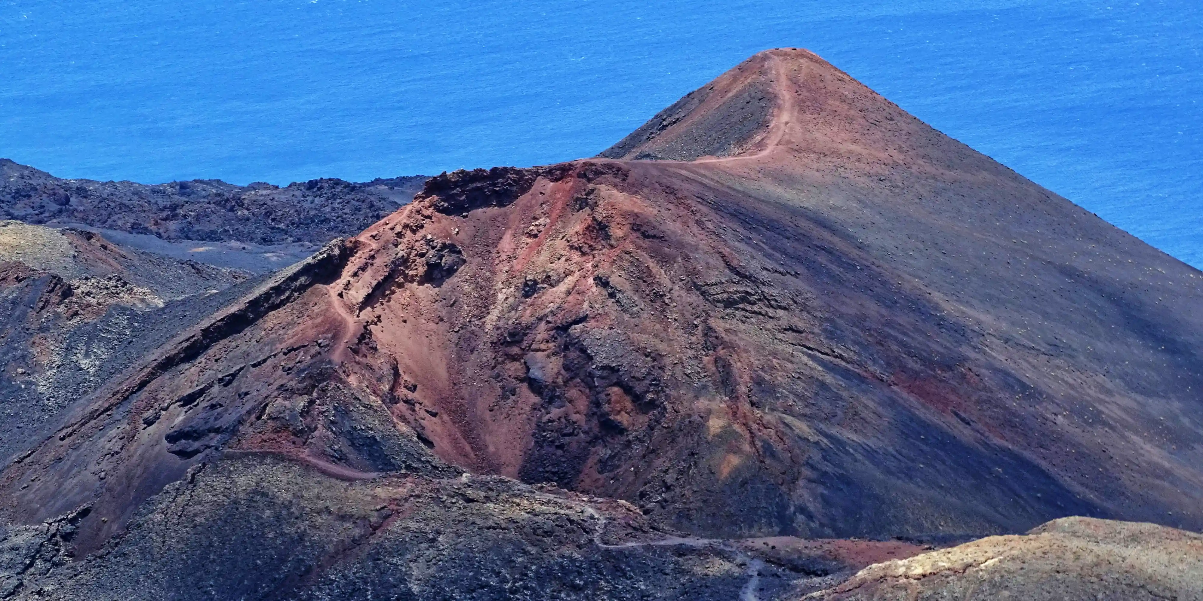
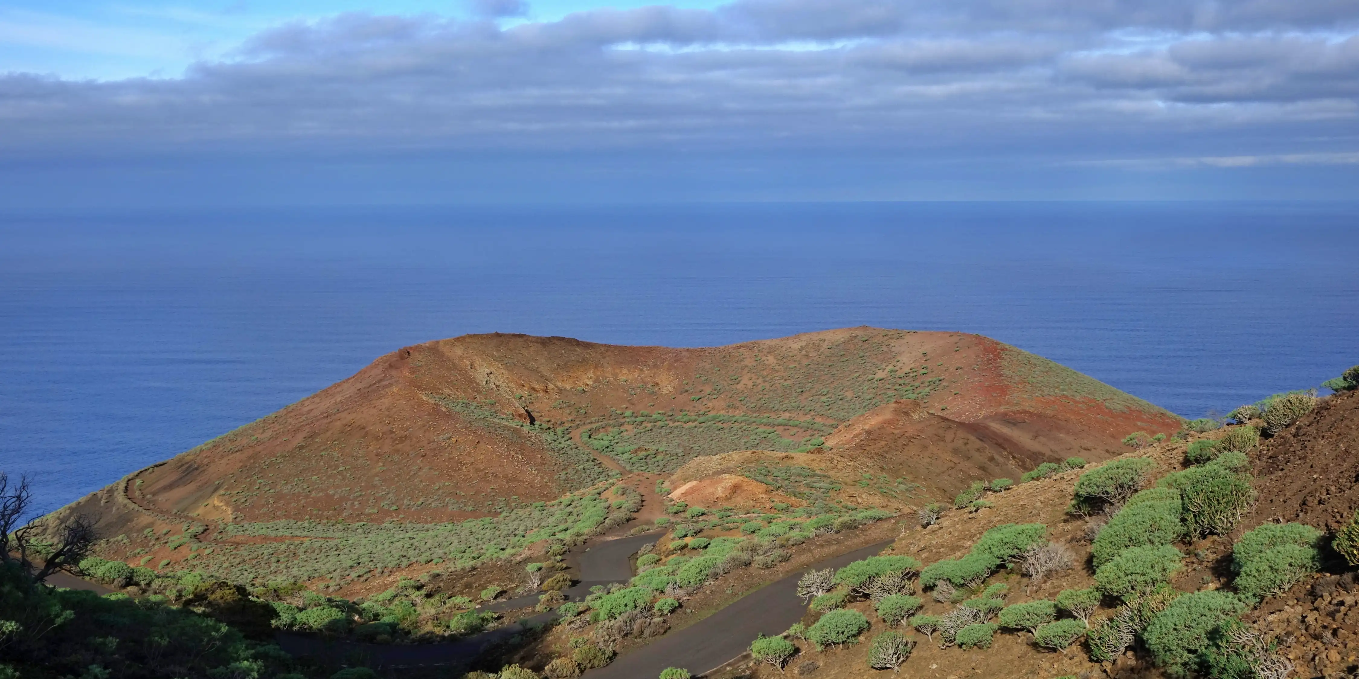
1971 – Teneguía (La Palma)
Location
Fuencaliente, southern tip of La Palma
Background and history of the eruption
The eruption of the Teneguía volcano began on October 26, 1971, and lasted only about three weeks. Despite its comparatively short duration, it is one of the best-documented volcanic eruptions in the Canary Islands, as it occurred at a time of modern measurement methods, photography, and film recordings.
The eruption was predominantly effusive, with lava fountains, ash emissions, and several lava flows. One of these flows reached the Atlantic Ocean and created new land along the coast - an impressive example of how the islands continue to grow to this day. During the eruption, evacuations took place, but there was only one known fatality, caused by inhalation of volcanic gases.
Teneguía is a classic monogenetic cinder cone formed by a single eruption. Its shape is exceptionally well preserved to this day. Geologically interesting is its clear connection to the fissure zone of the Cumbre Vieja, which demonstrates how volcanic activity continues along this line.
Visiting and hiking opportunities today
Teneguía is considered one of the best and most accessible volcanoes in the Canary Islands. The hikes are not very strenuous and can easily be completed within half a day.
Guided hikes
Regular guided volcanic hikes are offered at Teneguía. Guides clearly explain how quickly a volcano forms and which processes took place during the 1971 eruption.
Visitor Center Fuencaliente
The Fuencaliente Visitor Center perfectly complements a visit to the volcano with exhibitions on the volcanic history of the southern tip of the island, photos and films of the 1971 eruption, models explaining the formation of cinder cones, as well as information on San Antonio, Teneguía, and the Cumbre Vieja. From the viewpoints around the center, you also have magnificent views of craters, lava fields, and the Atlantic Ocean.
Tip for your vacation: Combine a visit to Teneguía with San Antonio volcano and the Fuencaliente salt flats. This way, you can experience over 300 years of volcanic history in a single day - compact, impressive, and easily accessible.
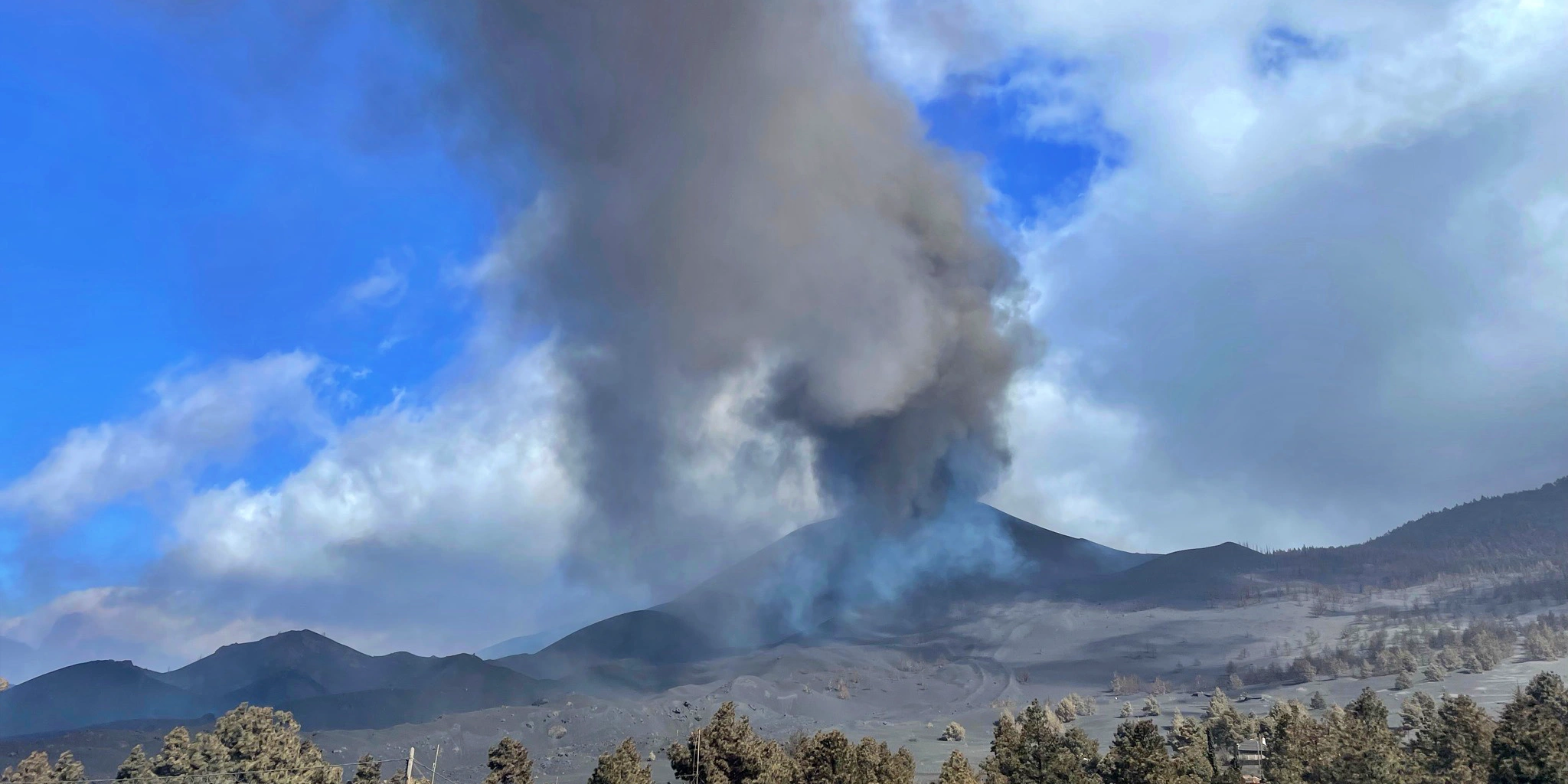
2021 – Tajogaite (Cumbre Vieja, La Palma)
Location
West of La Palma, municipalities of El Paso, Los Llanos de Aridane, and Tazacorte
Background and history of the eruption
The eruption of Tajogaite began on September 19, 2021, and ended on December 13, 2021 - with a duration of 85 days, it was the longest and most destructive volcanic eruption in the known history of La Palma.
After several days of increasing earthquakes, a fissure opened on the western flank of the Cumbre Vieja. In the following weeks, numerous vents formed, emitting lava fountains, ash, and gases. The lava flowed downhill in several tongues, repeatedly reached the Atlantic Ocean, and formed new coastlines (lava deltas).
The eruption led to the destruction of more than 2.600 buildings, large parts of the infrastructure, and agricultural land, especially banana plantations. Around 7,000 people had to be evacuated. Despite the enormous destruction, there were no direct fatalities caused by lava.
Tajogaite is a complex fissure volcano that changed continuously during the eruption. Particularly remarkable were the rapid formation of several cinder cones, extremely high lava output rates, and strong gas emissions (especially sulfur dioxide).
Visiting and exploration today
Access to Tajogaite is deliberately very strictly controlled in order to ensure safety, nature conservation, and respect for those affected. Large parts of the eruption area are closed, and direct access is only permitted as part of guided tours. Several viewpoints offer safe views of the lava fields and the crater. In places, the landscape appears moon-like - black, rugged, and barely vegetated.
Guided tours (mandatory)
Visiting Tajogaite is only possible with certified guides. These tours are strictly regulated and include safety monitoring (gases, heat, ground conditions), in-depth explanations of the course of the eruption, classification of the geological processes, and a respectful approach to destroyed settlement areas. The tours are generally of moderate physical difficulty but require sturdy footwear and good basic fitness.
Visitor information and knowledge transfer
A large dedicated visitor center is currently under construction. At present, information is available at the San Antonio Visitor Center and from local guides with official authorization. There is also the Caños de Fuego Center (lava tubes) near Las Manchas, which focuses on lava tubes formed after the 1949 eruption but is also relevant to the new volcano, as it explains the formation of the landscape.
Tip for your visit: Inform yourself in advance about current access regulations and book only official tours.
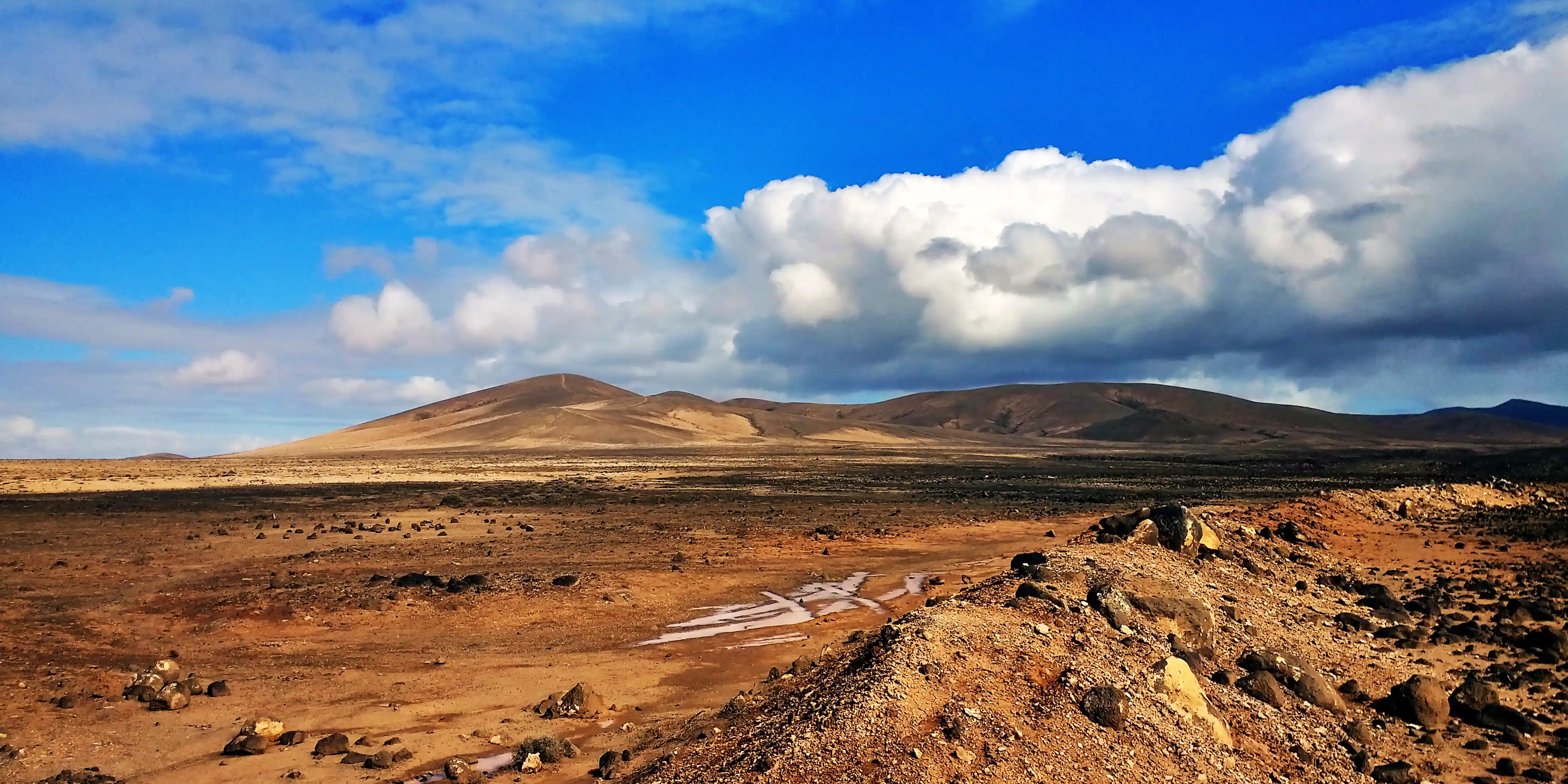
Lanzarote – The Fire Mountains
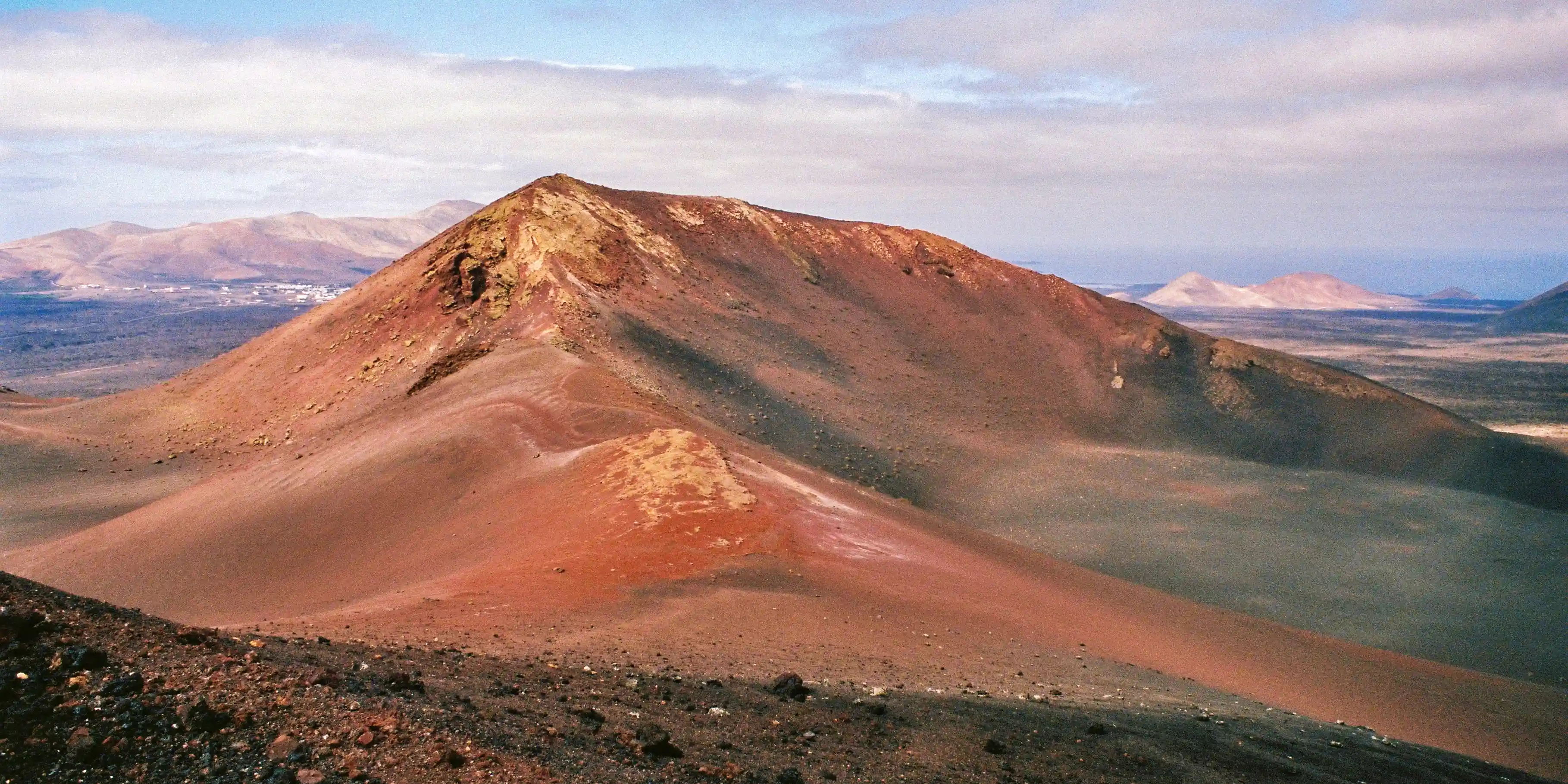
1730 to 1736 – Timanfaya (Lanzarote)
Location
Central Lanzarote, present-day Timanfaya National Park
Background and history of the eruption
The Timanfaya eruption is considered one of the most powerful and far-reaching volcanic eruptions in the history of the Canary Islands. It began on September 1, 1730, and lasted - with short interruptions - until 1736, meaning almost six years of continuous volcanic activity.
Contemporary chronicles report fire fountains, ash fall, and lava flows erupting day and night from numerous fissures. In total, more than 25 new volcanic cones were formed, and around a quarter of the island of Lanzarote was either completely destroyed or permanently reshaped. Villages, fields, and grazing land disappeared beneath meters of lava and ash.
The eruption not only transformed the landscape but also permanently changed the lives of the population. Many people were forced to leave their homes, famines occurred, and Lanzarote came close to being abandoned as a habitable island.
The Timanfaya eruption was a long-lasting fissure eruption, during which new openings repeatedly formed along tectonic lines. The lava was predominantly basaltic, extremely hot, and extraordinarily productive. Particularly remarkable is the formation of one of the largest continuous lava fields in Europe. To this day, residual heat remains active underground, with temperatures of several hundred degrees just a few meters below the surface. This persistent heat makes Timanfaya unique worldwide.
Visiting and exploration today
Today, the eruption area is strictly protected as Timanfaya National Park and is one of the most famous natural highlights of the Canary Islands. Access is only possible via designated areas, and individual hiking in the core zone is not permitted. A bus tour takes you through the heart of the volcanic area, impressively explaining the formation, duration, and impacts of the eruption.
A special highlight are the geothermal demonstrations at Islote de Hilario, where water instantly vaporizes into a fountain, straw ignites due to the heat in the ground, and measurements show extreme temperatures close to the surface - making the still-present volcanic energy directly tangible.
Visitor information and knowledge transfer
The Mancha Blanca Visitor Center is the ideal introduction to the national park. It features models of the historic eruptions, films and display panels on the formation of Lanzarote, information on flora, fauna, and the protected area, as well as easy-to-understand explanations suitable for families. Additionally, a visit to the Centro de Visitantes e Interpretación de Timanfaya is worthwhile for deeper insights.
Tip for your visit: Visit Timanfaya as early in the morning as possible to avoid long waiting times. Combine the national park with a detour to La Geria to see how people have learned to live on volcanic soil - a fascinating contrast between fire and fertility.
1824 – Tao, Nuevo del Fuego & Tinguatón (Lanzarote)
Location
Central Lanzarote, in the surroundings of the villages of Tao, Mancha Blanca, and Tinguatón
Background and history of the eruptions
After the devastating Timanfaya eruptions of the 18th century, volcanic activity returned to Lanzarote in 1824. Within a few months, several short, partly explosive eruptions occurred, distributed across three main centers: Tao, Nuevo del Fuego, and Tinguatón.
The eruptions each lasted only days to a few weeks but were accompanied by strong explosions, ash fall, and lava emission. Contemporary reports describe loud detonations, ground shocks, and dense clouds of smoke. The lava flows generally remained locally confined but caused damage to agricultural land. No fatalities are documented.
The eruptions of 1824 clearly demonstrate that volcanism on Lanzarote did not end with Timanfaya. These events were predominantly Strombolian eruptions, ejecting scoria, ash, and volcanic bombs. The Tinguatón volcano is particularly interesting from a geological perspective. Nuevo del Fuego (“new fire”) received its name due to its fresh appearance immediately after the eruption.
Visiting and hiking opportunities today
In contrast to the strictly protected Timanfaya National Park, the area of the 1824 volcanoes is freely accessible and ideal for individual exploration. The hikes are technically easy but require sturdy footwear, as the lava can be sharp-edged.
Guided hikes
Geologically guided tours are also offered, allowing you to understand the differences between the eruptions of 1730–1736 and 1824 and to learn more about the historical significance of the events.
Visitor information
There is no dedicated visitor center for the 1824 eruptions. However, the Mancha Blanca Visitor Center (Timanfaya) is recommended.
Tip for your visit: Visit the Tinguatón volcano early in the morning or late in the afternoon. The low light highlights the lava structures particularly well and makes the crater hike an unforgettable experience.
El Hierro – Submarine volcanism
1793 – Lomo Negro (El Hierro)
Location
Interior of the island of El Hierro, near Valverde / central highland area of the island
Background and historical context
The eruption of Lomo Negro in 1793 is a historically documented but only sparsely recorded volcanic eruption on El Hierro. It occurred at a time when the island was sparsely populated and written records were rare. Accordingly, only a few contemporary accounts exist regarding its duration and exact course.
According to current knowledge, it was a short, locally confined Strombolian eruption, during which lava and scoria were emitted from a single vent. There is no evidence of fatalities or major destruction, largely due to the remote location in the island’s interior.
Lomo Negro is a classic monogenetic cinder cone, typical of El Hierro.
Visiting and hiking opportunities today
The region around Lomo Negro is today a quiet, unspoiled volcanic landscape, far removed from mass tourism. The scenery is less spectacular than younger lava fields but conveys an authentic impression of the island’s older volcanism.
Guided hikes
Guided tours are not offered regularly but are occasionally available as part of geological themed hikes, natural park excursions, and local environmental programs.
Visitor information
There is no dedicated visitor center. For background information, the Centro de Interpretación Vulcanológico on El Hierro, information panels in nature and hiking areas, as well as local guides and hiking literature are recommended.
Tip for your visit: If you want to explore El Hierro away from the well-known routes, Lomo Negro is ideal for experiencing the island’s geological power in a peaceful setting.
2011 to 2012 – Submarine eruption El Discreto (El Hierro)
Location
Atlantic Ocean off La Restinga, southern tip of the island of El Hierro
Background and history of the eruption
The submarine eruption El Discreto began in October 2011 and lasted until March 2012. It is considered the first fully documented submarine volcanic eruption in Spain and suddenly brought El Hierro to worldwide attention.
Months earlier, scientists had already recorded thousands of earthquakes, ground uplift, and gas emissions. Eventually, a submarine vent opened south of La Restinga, from which lava, gases, and pyroclastic material were emitted. At times, the sea turned greenish-brown over large areas, caused by volcanic gases, minerals, and microorganisms. The eruption led to the evacuation of the village of La Restinga but proceeded without human casualties.
El Discreto is a prime example of submarine volcanism, as the volcanic cone grew from the seafloor to about 90 meters below the water surface. During the eruption, porous lava bombs (“Restingolitas”) formed, strong chemical changes occurred in the seawater, and the event was intensively monitored scientifically in real time. The eruption provided valuable insights into the formation of the Canary Islands, which largely begin underwater.
Even though the El Discreto volcano itself lies underwater, the eruption area can still be experienced very well today: viewpoints above La Restinga offer wide views over the ocean, coastal walks are accompanied by information panels, and the sea remains geothermally influenced. The idea that a young volcano lies beneath the water surface is particularly impressive.
The area around La Restinga is also considered one of the most exciting diving areas in Europe. Diving here is only permitted with official authorization and certified dive centers, but it offers unique underwater landscapes with new lava formations, extraordinary biodiversity, and visible traces of the eruption on the seafloor. This ecological renewal triggered by the volcanic eruption now attracts divers from all over the world.
Visitor information and information panels
In La Restinga, you will find several information panels about the eruption, maps and photos of the eruptive phases, as well as explanations of the evacuation and research. In addition, the Centro de Interpretación Vulcanológico on El Hierro provides further information on the island’s volcanism.
Tip for your visit: Plan your visit to La Restinga with a walk to the viewpoints and combine it with a snorkeling or diving trip (with certified providers). Hardly any place in the Canary Islands combines modern volcanism, science, and nature experience as impressively as this one.
Gran Canaria – Overview of volcanic activity
Gran Canaria is geologically older and more strongly eroded than Tenerife, La Palma, or El Hierro. The island formed in three major volcanic phases that shaped today’s landscape - with calderas, volcanic cones, lava plains, and ravines.
Approx. 14 to 9 million years ago – Shield volcano phase (island formation)
Location
Entire island (submarine → subaerial)
Background and history
During this phase, Gran Canaria formed as a massive shield volcano, similar to present-day Hawaiian volcanoes. Low-viscosity basaltic lava flowed over long periods and built the island up from the Atlantic. This phase made Gran Canaria habitable in the first place—without it, the island would not exist.
Traveler’s tip: The coastal road in the west shows impressive lava sequences.
Approx. 5.5 to 3 million years ago – Caldera eruptions (Tejeda phase)
Location
Island interior – Caldera de Tejeda
Background and history
This phase was explosive. Massive eruptions led to the collapse of the central volcano and the formation of the Caldera de Tejeda, one of the largest erosional calderas in the Canary Islands. Ash, ignimbrites, and pyroclastic flows covered large parts of the island.
Visitor information
Centro de Interpretación del Roque Bentayga and information panels in Tejeda
Tip: The heart of the island – a must for every visitor.
Approx. 3 to 1,5 million years ago – Late volcanism and secondary craters
Location
North & east of the island
Background and history
After the collapse of the central volcano, numerous smaller eruptions occurred, forming cinder cones and lava fields. These eruptions were less destructive but shaped large parts of today’s northern regions.
Approx. 2.000 to 3.000 years ago – Caldera de Bandama (youngest eruption of Gran Canaria)
Location
Northeast Gran Canaria, near Las Palmas
Background and history
The Bandama eruption is the most recent known volcanic eruption on Gran Canaria. It was explosive and created the Caldera de Bandama, an almost circular crater about 1,000 meters in diameter. The eruption occurred before the Spanish conquest, possibly even before the arrival of the indigenous Canarians.
Visitor information
Bandama Visitor Center
La Gomera – Overview of volcanic activity
La Gomera was formed around 12–10 million years ago through volcanic activity, but it is significantly older and more heavily eroded than Tenerife, La Palma, or El Hierro. For around 2–3 million years, volcanism has been considered extinct. Instead of new lava, deep ravines (barrancos), cloud forests, and ancient volcanic cores now shape the landscape.
Approx. 12 to 8 million years ago – Island formation (shield volcano phase)
Location
Entire island (submarine → subaerial)
Background and history
Like most of the Canary Islands, La Gomera formed through long-lasting, effusive volcanism. Low-viscosity basaltic lava built the island layer by layer until it rose above the Atlantic Ocean. This phase was comparable to the early development of Gran Canaria - however, without later reactivation.
Approx. 8–5 million years ago – Explosive phase and intrusions
Location
Island interior
Background and history
During this phase, more explosive eruptions occurred, along with the formation of intrusions (solidified magma underground). The actual volcanic cones are now almost completely eroded. What remains are hard rock cores that resisted erosion.
Approx. 5 to 2 million years ago – End of volcanism & erosion
Location
Entire island
Background
Volcanism came to a definitive end. Instead, an intense phase of erosion began, driven by rainfall, wind, and tectonic uplift. The result: deep, radially arranged barrancos.
Fuerteventura – Overview of volcanic activity
Fuerteventura is the oldest of the Canary Islands. Volcanism has been extinct for several million years. There are no historically documented eruptions, but numerous prehistoric volcanoes that are very accessible today and ideal for visitors. Fuerteventura represents the beginnings of Canary Island volcanism - strongly eroded, dry, and expansive.
Approx. 22 to 20 million years ago – Island formation (shield volcano phase)
Location
Entire island (submarine → subaerial)
Background and history
Fuerteventura formed as one of the first Canary Islands through long-lasting, effusive eruptions of low-viscosity basaltic lava. Over millions of years, a large shield volcano rose from the Atlantic Ocean. This phase laid the foundation for today’s island - much earlier than on any of the other Canary Islands.
Approx. 20 to 14 million years ago – Central volcanic phase & intrusions
Location
Island interior (Betancuria Massif)
Background
During this phase, volcanism intensified and included explosive components. Magma intruded into the subsurface, solidified there, and was later exposed by erosion. The Betancuria Massif is considered the geological core of the island.
Visitor information
Museo Arqueológico de Betancuria as well as information panels along the barrancos
Approx. 5 to 4 million years ago – Late volcanism (youngest eruptions on Fuerteventura)
Location
Northern Fuerteventura (Malpaís de la Arena)
Background and history
The youngest known eruptions on Fuerteventura occurred around 4–5 million years ago. They led to the formation of cinder cones and lava fields - significantly younger than the rest of the island, but still very old in geological terms.
Volcanic highlight: Calderón Hondo (Northern Fuerteventura)
Location
Near Lajares
Background
Calderón Hondo is not a historical eruption, but one of the best-preserved prehistoric volcanic craters in the Canary Islands. It formed during the island’s late volcanic phase.
The volcano is ideal for a short and easy crater hike, is well suited for families, and rewards you at the crater rim with wide views all the way to Lanzarote. Information panels explain the local geology, and admission is free.
Flexibly and relaxed to the most impressive volcanic landscapes of the Canary Islands
With a rental car, you can explore the impressive volcanic landscapes of the Canary Islands in a particularly relaxed and flexible way, as many volcanoes, lava fields, and viewpoints are located in remote regions between coast, high plateau, and mountains. You can easily reach hiking trailheads, visitor centers, and spectacular miradores, drive through black lava deserts, pine forests, and calderas, and stop spontaneously along the way at beaches, natural pools, or small villages.
Your vehicle will be waiting for you directly at the airport, with no excess, an additional driver included, and flexible cancellation up to 48 hours before arrival - allowing you to remain independent and enjoy the volcanic diversity of the Canary Islands at your own pace.
Ready to discover the fascinating volcanic world of the Canary Islands?
Now is the perfect time to plan your trip. Our team knows the Canary Islands and their impressive volcanic landscapes firsthand and will help you find the right accommodation - amid black lava fields, near spectacular viewpoints, or relaxed by the coast.
Whether you set out on a volcanic hike in the morning, explore visitor centers and lava fields in the afternoon, or enjoy the sunset over the Atlantic Ocean, we make sure you feel at home on the Canary Islands from the very first moment.
Let our Canary Islands experts advise you and experience an unforgettable volcanic vacation under the sun of the Canary Islands.
Email:
Phone: +34 675 400 700